"Oregon High: A Climbing Guide to Nine Cascade Volcanoes", Jeff Thomas, 1991
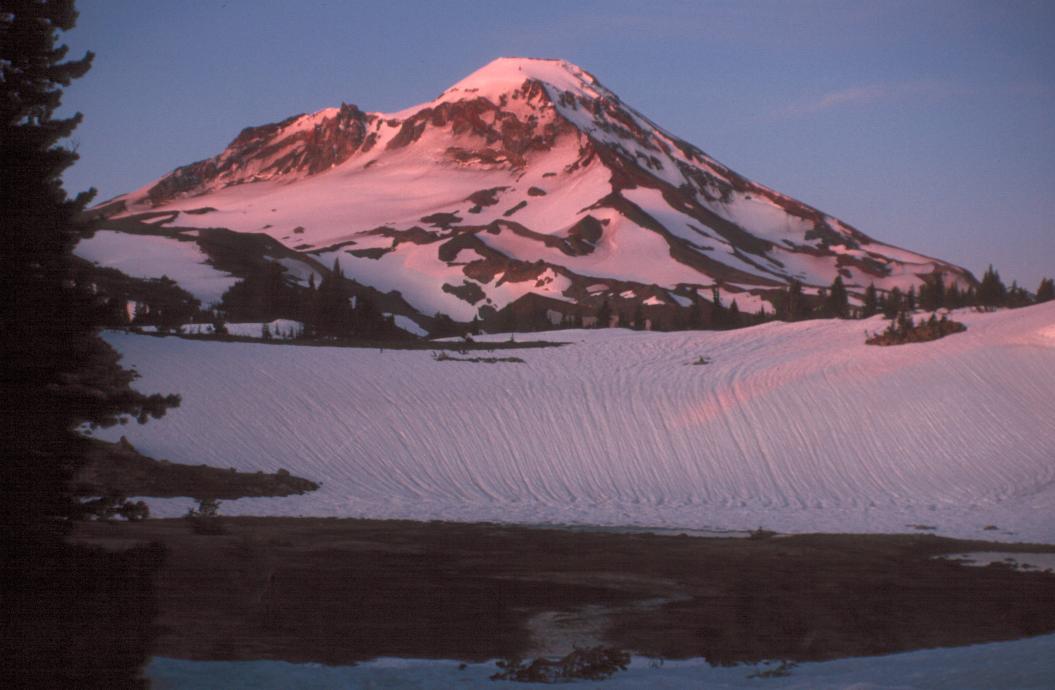
"The North Ridge is the best route for parties wishing to approach South Sister from the north, including climbers trying to complete a Sisters Marathon. Most of the North Ridge is a grunt up a typical Oregon Cascades volcanic ridge. The crux of the climb is moving around the right (west) side of a large rock buttress at about 9800 feet. Above the buttress, follow the lower-angle slope to the summit."
My 'good ol' climbing buddy Glenn talked about this for quite some time. The prospectus said we would be climbing South Sister and Middle Sister, the third and fifth highest peaks in Oregon.
We got a typical start from Glenn's house (later than planned) at about 1030. This put us at the trailhead at about 2 PM. All together there were four of us: Glenn, Dave Shapiro, Dr. Richard Brower, and me. We had all climbed with Glenn before, Dave and Richard had done Hood and Adams and I had attempted Mt. Washington. Before we left, Glenn's wife asked me to watch out for Glenn and make sure he didn't do anything "too dangerous". I had no way of knowing how much I would consider this request the next two days.
This has been a disgusting summer for climbing in Oregon, actually more like late spring. We were EXTREMELY fortunate to find a weather window that coincided with our plans, although we did have to delay a day to start. We were also expecting snow at base camp or before, so Glenn and Dave brought their cross-country skis.
The concept of skis on packs was obviously new for both Glenn and Dave. At the trailhead Glenn put his pack (with the skis on) on and THEN proceeded to bend over to pick something up. He succeeded in konking Richard with his skis in a move that was pure Three Stooges. The rest of the way in and out one or the other of these two would suddenly stop and back up after hitting a branch that Richard or I had walked easily under. It worked out very well later, when this extra meter or two acted like a bike safe flag, and allowed me to track them even when they had dropped down below a ridge.
I almost gave up the first half-hour; the trail started up immediately. But after a short stop for carbs and water I did much better. The first person we met was a mounted trail patrol. We asked her if we could borrow her horse to carry our packs. She smiled politely, but declined.
We crossed Soap creek on a well-prepared log bridge. Very nice, with a flattened top and steps cut in one end. The next stream we crossed was on stepping stones. Finally Squaw creek was simply three felled trees, with most of the branches hacked off.
As we hiked up the trail we began to see patches of snow. Some of them began to cover the path. Just before the Squaw creek the patches started to get bigger. It was about this time that we saw the last people of the day, a horse party. Their point person told us to talk to the horses, because the packs and skis frightened them and our talking would calm them down. (Yeah, but who can talk calmly to something that can easily CARRY me?)
After we crossed Squaw creek the trail virtually disappeared under snow. It was about 5 PM and the wind was picking up. We started up a snowfield that sloped steeply down to the creek. It was quite steep. We stopped at one point to get ice axes off our packs before attempting to continue. Most of us also managed to struggle into some warmer clothing. Glenn asked me to get his polypro top off his pack, only to discover it was not a top but a bottom. Well, Glenn is someone who will put his long john bottoms on one arm at a time, if he has to.
We got around this slope about 6 PM and onto something more reasonable, then saw another 20 foot snow bank looming ahead. At this point I began to tease Glenn about wanting to go "A Ridge Too Far", while actively lobbying for a quick choice of campsite. We got up the last rise, then found a nice sheltered spot next to a large pool of snow melt which made an excellent camp. We were probably a mile northeast of our destination of Camp Lake, another fateful choice.
Dave was my tent partner (his tent) and he got it pitched while I started the stove and boiled water. I also prepared my summit pack and other gear for the next morning's early start while I waited for my freeze dried "Red Beans and Rice" to cook. I had thought ahead enough to bring a bottle of "McIlhenny's Finest" Tabasco(R) sauce, which made it taste fine. Glenn and Rick borrowed it for their Macaroni and cheese. We decided to try South Sister the next morning. It was the more technical of the two routes, so we all prepared accordingly.
We got up at 3:30, and Glenn figured we would summit by noon. It took until 5 until we were fed and dressed and ready to mount up. We went on what we thought was the trail, with Glenn leaving wands at strategic junctions so that we could find our way back to camp. We gave Glenn a hard time because his wands were topped with florescent PINK triangle shaped flags. This, coupled with Richard's observation that Glenn's attempt to keep his gaiters up with cords strung to his waist was "gaiter garters", put us into quite a jocular mood as the sun rose.
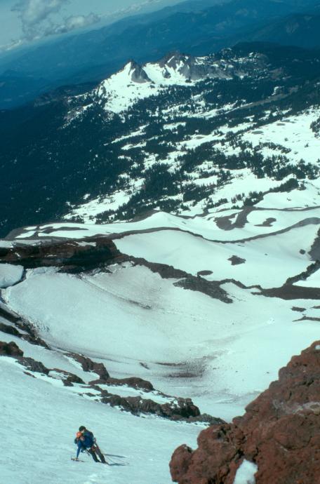
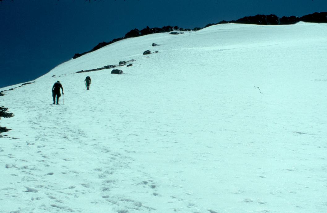
We started to gain elevation, and soon we were looking down on Camp Lake from the north. Unfortunately, we were TOO far north. A "Ridge Too Far" north. So we traversed through "The Devils Parlor", heading due south toward the north ridge of South Sister. I was quite amazed to see deer tracks in the snow. Apparently this is a migration pass from east to west for the deer. We stopped about 7AM to put on crampons so that we could move quicker in the hard snow. I had been fortunate enough to rent "step in" crampon bindings and was amazed that I had both mine on while Rick and Glenn laced up one of theirs. It was nice at first to have the security of steel into snow, but several times we had to cross ridges of scree and rock, which made sounds almost as annoying as fingernails on a blackboard. We were still in the Devil's Parlor at about 8 AM. Glenn told me to give my rope to Rick to help speed me up. We took off again, although none of us matching what Richard called "the pace from hell", which Glenn is somehow able to maintain. About this time I spotted a party about a mile ahead of us, ascending the snowfield just west of the Carver Glacier.

We continued on, crossing one last ridge of scree and finally ending up on the same snowfield. Glenn decided to cache his skis here. I saw several rocks come rolling down the slope and decided that it would be a good idea to put my helmet on. The climbing got to be a real slog and I felt I was holding up the group. But they waited for me at the top of the snowfield before crossing onto another ridge of scree.

The others kept their crampons on but I realized that I had step-ins, so I could easily doff mine. So I did, and seemed to make better time on the miserable stuff. I caught up with the guys at the edge of the scree field. Glenn had decided that it would be easier to climb on the ice with crampons and picks than it would be to slog up the scree. So we put on harness and tied into the rope.
As I tied in I looked up the route. Fifty-degree ice for probably 200 feet, then traversing under the buttress on the ridgeline which is the crux of the route. Then I looked down the route. Forty five-degree ice for over 500 feet, then a run out. I looked up, and I looked down. I finally realized why my stomach and intestines were upset. I was scared. (Glenn later said he was watching me and expected me to back out.) I tied into the rope, put my crampons on, stood up and stepped out onto the ice.
It was not as terrible as I feared. In fact it was a relief to be doing the type of thing I feared. Glenn and Dave moved up and right, I lead Richard after them. While we were doing this I saw the descending party move over the upper edge and into the moat. THEY WERE NOT ROPED! They also started a rain of ice missles down the slope onto us. When they were even with us, in the boulder field, we shouted over to them. They were the team from the Mazamas that we knew were scheduled to be doing the same route. Their leader commented that we were ascending much too late. (It was now nearly noon.) My thought was "no kidding".
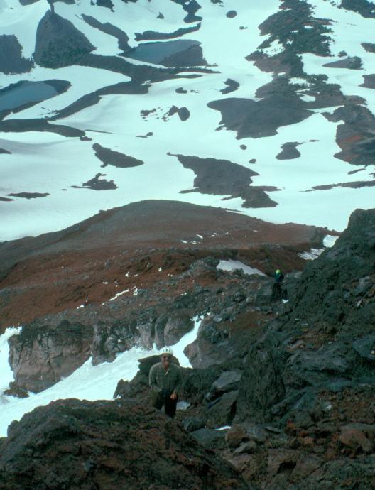
We continued climbing and finally made the ledge at the bottom of the buttress. We watched as the other party picked carefully through the boulder field. Next Glenn started up the moat around the buttress. Rick and I followed a few minutes after. This area was not too bad. A little exposed in places, but nice, somewhat solid, rock on one side and a large snow/ice drift on the other. Rick and I moved up quickly. Suddenly I saw a softball-sized rock hurtling down. Crack.
"Shit!"
"Are you all right, Rick?"
"I'm checking." A long pause. He's CHECKING? "It hit my right tibia. I don't think anything is broken, just bruised."
Then another, smaller rock bounded down and hit me in the thigh. Had it hit two inches further left I would have been in REAL pain. We got up to an almost vertical final section of 30 feet. It was 1 PM and I was really concerned because we would have to come back down this stuff, only it would be softer and more melted. Richard looked at it. I looked at it. Glenn shouted down and offered to belay up. I accepted. It took three tries to throw the rope down. I finally got it and tied in. Then I started to climb. I slipped once or twice. I finally got to where I could see Glenn. I reached out to grab a beautiful rock handhold, only to have the rock move about three inches. Needless to say I changed holds quickly. Glenn was watching and said, Oh, yeah, Forgot to warn you about that rock... I got up to Glenn and then handed him the rope to belay Rick up. We had passed the crux and gotten to the final gentle slope.

We stopped for a little water and to unrope and take off harness. Then Rick and Dave started to the summit. I started, then decided to drop my pack and took my ice axe and dug a cat hole. It was some relief for my belly, but not much. I knew that we had to go back DOWN this way.
From here on it was a slog to the summit. Glenn, Dave, and Rick all quickly outpaced me and I watched them climb over the rim rocks. I got over the rim and walked to the benchmark, touching the brass plaque. I turned around and headed back down. It was 2:20PM. Even with this head start, the other guys beat me back to the crux.
This was the final tense part. I tried to eat a slice of bread, but could only get through half. I drank a little of my water, but I only had about a half a liter left. I popped two lemon drops, which helped. As we roped up we discussed the descent strategy. Rick would go first, Dave next, then me, all on one rope. Glenn belayed Rick, who got down to the mid point on Glenn's rope before he found a decent ledge. Then Dave clipped in and was over the edge. Rick moved lower while I tied into the end of that rope and the end of my rope. Glenn belayed me over the edge. I went down the snow slope on front points and pick. I slipped once or twice. My mantra the whole time was "don't fall. Don't fall. I descended enough, then moved left into the moat. I reached the ledge next to Dave, shouted to Glenn and began to set up a boot ax belay.
Fortunately, my basic school instructor, Dick Miller, had shown a trick to this technique. I jammed my ax, spike first, into the snow as far as it would go. I pulled on it and broke the snow away. I found another likely place and tried again. The shaft went in about two thirds of the way. I then pulled a prusik sling off my harness and threw a girth hitch around the shaft of the ax, sliding it down to the level of the snow. I clipped a carabiner into this sling, then the rope to Glenn into the carabiner. Finally, I stepped on the sling. (Carefully, so the sling was between the teeth of my crampons.) Now I was ready to belay Glenn down.
Glenn started down. I recited my mantra, Don't fall, DON'T FALL, the leader must not fall. I watched as Glenn carefully came down, finally to my level, finally into the moat. I suggested that he continue on down. He did, finally finding a decent place to stop before I ran out of rope. I then began to belay Dave down. By now Richard was moving again. I finally took Dave off belay and started down myself. I continued down and passed Glenn. By now we were all moving at once, although carefully. I moved down and around one exposed corner. Dave yelled up that Rick had made the "lunch ledge". I tried to go faster, but did not have enough slack from Glenn. The water was dripping off the rock and the snow was quite mushy. The leather gloves I was using were saturateed. I finally made the ledge, followed by Glenn, at about 4PM.
Here we finally unroped, packed our harnesses, coiled our ropes, and took off and packed our crampons. Then we began to descend the boulder field. This was quite different from Mt. St. Helens Monitor Ridge. This was no "rock hopper" playground. The exposure was stupendous; the ridge dropped off 50 to 100 feet off either side. Glenn and I carefully picked our way down this until it gradually eased out into a miserable scree slope. By this time Glenn was well ahead of me. Richard had taken a gully off the ridge to the west (another "ridge too far") - started out just a few feet left and below us, but quickly he disappeared from sight, for a long time. Dave was all the way down to the snowfield, starting to glissade. My legs were like Jell-O(R), so I very carefully walked down through the mixed boulders. I finally caught up with Glenn at the edge of the snowfield. He was preparing to glissade, and said he would look for Richard as he descended. Off he went, yelling, but moving under apparent control.
I prepared myself next. I sat on the plastic I had brought, tucked my ice ax behind me to steer or brake with. Then I lifted my feet. ZOOOM! I was off. Faster, FASTER, brake, BRAKE, BRAAKE! BAIL OUT! I rolled over into self-arrest and dug the pick of my ax into the snow. I SLID! I SLOWED! I stopped. OK, still no Rick. Glenn is down to his skis; Dave has his skis on. OK I'll try again. WOOOOOW!! Another self arrest. There is Rick, he descended in the other snowfield. He is already down by Glenn and Dave. OK, one more slide. This time I use my heels and the ax. Also the slope is not so steep, so I don't get going quite so fast. I am soaked but alive and I finally walk over to the other guys. It is 6 PM.
At this point we buddy up. Glenn and Dave will ski out and Rick and I will walk. We begin the long slog to camp. Finally we start to see the wands that we left this morning, twelve hours ago. As Rick and I walk we do not realize that we are ahead of Glenn and Dave. But soon they catch up and beat us back to camp. Barely. It is 8:30 PM. Fifteen and a half-hours of pure climbing fun.
We began to take off our clothes and get into dry warm clothes, and boil water for dinner. Some time during the descent we decided not to attempt Middle Sister. (Maybe it was during the ascent?) As the mosquitoes get worse I brush my teeth and go to bed.
I woke at 2:30 and stepped out of the tent. (Over four hours of sleep for me, a minor record!) I check out the sky, which looks overcast. I think I see lighting in the distance. Oh well, back to bed.
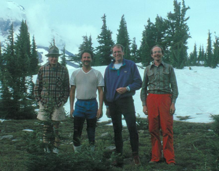
I woke again at 5:30. As I lay there I began to hear the sound of rain on the tent. I started to move out of the tent fast and got the stove started for breakfast. Fortunately the sprinkles tapered off, but everyone else was awake so we started with breakfast and the packing routine. Glenn went wild cooking, making quesadias, rice pilaf, and several other things. Yes, with Tabasco(R). We got most everything prepared, eaten, packed and sorted out by about 9 AM. Then we stopped for a picture, hoisted our packs and headed out, pulling the wands out as we found them.
The one scary spot for me was the snow-covered slopes before Squaw creek. These were bad enough going up, but worse going down. With the frame pack I had, and my lugless hiking boots, I had very little confidence. I made it past the first drop, and then we took off for the steep place we had seen on the way in. Fortunately Glenn found a path clear of snow near the creek, and even I, the world's biggest chicken, made good time.
We found the creek crossing, but on the other side proceeded to take a wrong turn. We lost the trail and started to bushwhack, by map and compass, through the woods, trying to go up hill. We did this for about a half an hour before I finally said, "Nuts". Took off my pack and fished out my compass. I put my pack back on and we went only a short way before finding a short cliff, the final "ridge too far". Of course at the bottom of the cliff was the trail. So we picked our way carefully down to the trail and continued on our way.
About now it started to rain lightly. We continued to hike, stopping only for quick breaks. The rain was light enough to only soak the top layer of soil, which clung to our boots and was then flung back and up at each step. We crossed the two creeks, and made it back to the trailhead by 12:45. Here we sorted out the gear, packed the truck. Took pictures of our packs (before they went into the truck) and changed into some clean clothes. Clean underwear felt especially nice.
We took off down the road and drove the 10 miles back into Sisters. Once there we walked around town, (I limped) looking for a place to celebrate. We finally stopped at a deli. Affter a sandwich and rootbeer almost felt like going climbing again. But Glenn talked us into going out to visit his friend Joan. We stayed and talked to her until about 5:30, then finally headed home to Portland.
Tuesday I went back to work, several people stared at me when I walked in. The left side of my face was badly sunburned, with a diagonal line across my face dividing the totally roasted from the not so bad. At least my limp eased up after Thursday.